|
|
|
|
|
|
|
|
|
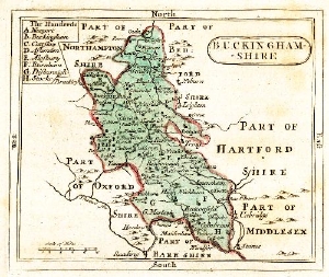
The 'historic counties' used for the listing in the Gatehouse website are those used by David Cathcart King in his seminal Castellarium Anglicanum (The book which is the main inspiration for this site) which approximate to the situation just prior to the major changes of 1974 although he separately listed the Isle of Scilly and Lundy Isle (instead of including these in Cornwall and Devon respectively). Within each site page the 'county' authority in 1974 and the current authority are also identified. An attempt is also made to identify the actual medieval 'county' and/or lordship, although the 600+ years covered in this database had changes and such identifications need to be considered with care.
Despite some common beliefs the counties of England have never been static and changes of a slight nature where boundaries were tidied up have occurred fairly often. Such changes took place in 1836 and 1968 with more major changes taking place in 1844 and 1888. County locations used in many older texts and primary sources may not be the same as the counties in 1973 used by King and here. Some of the more notable differences which may cause confusion because of the inconsistency between various sources are;
A major change of administrative areas took place in 1974 and again in 1996. Some sources will refer to administrative areas which were in existence between these dates. The Sites and Monuments records and the authorities with responsibility for recording and protecting historic sites are generally, at a local level, based on the new post 1996 administrative areas in England.
The smallest area of civil authority in England is the Civil Parish, this is used to locate sites is some sources. Modern administrative areas are also not entirely tidy and some non parish areas exist. It should be noted that the Civil Parishes do occasionally change names and boundaries so the Civil Parish given in older sources may not be the same as that given in Gatehouse. Civil Parishes are not the same as church parishes although they do often cover the same or similar areas and have the same or similar names. They are certainly not the same as medieval manors and any similarity in name must be treated with circumspection.
The medieval administrative area of Wales was the cantref (Plural Cantrefi) and it subdivision known as a commote (or Cymydau) (Click on the map for a map of the commotes). The so called historic counties were formed by statue in 1535, although some of the counties had existed since the 13th century. In Wales the Historic Environment Records (Sites and Monuments Records), although supposedly based on the modern authorities, are actually held by four archaeological trusts which are based on the 1974 administrative areas (Still having some legal status and technically called the Preserved Counties). It should be noted that the pre 1974 and post 1996 counties of Denbighshire and Flintshire are significantly different.
As with England there have been some smaller changes to counties other than the large 1974 and 1996 changes. Carreghofa, in Montgomeryshire, was in Denbighshire until 1844.
Monmouthshire has had a peculiar status, always closely connected to Wales, it was technically, for some purposes and for a long period, an English county. It is now officially part of Wales but some old sources might still refer to it as part of England.
The smallest area of civil authority in Wales is the Community, this is used to locate sites is some sources. It should be noted that Communities do occasionally change names and boundaries so the name given in older sources may not the same as that given by me. Communities in Wales are not the same as church parishes although they do occasional cover the same or similar areas and have the same or similar names.
Genuki does give some information on the various boundary change.
Welsh place names often have variant spellings. Welsh placenames can get anglicised spellings (i.e. replacing 'dd' with 'th' or 'f' with 'v' such as Caernarvon) and, particularly in the North-East of Wales, some English place names can be cymrised (i.e. Prestatyn was originally Prestetone or Preston). Attempts at producing 'standardised' welsh spelling often fail and can be irksome to some people. Few welsh people would want their anglicised surnames, of Jones, Davies and Williams to be changed to the 'proper' welsh names of Iones, Dafys and Gwilym and pedantic correctness about place name spelling can be nearly as offensive. There can be significant regional variations in spellings and pronunciation between North and South Wales.
Specific locations (where known) are given as Landranger map grid reference, usually 8 figure but occasionally 6 or even 4 figure. In the downloadable database Gatehouse also gives the 12 figure OS map grid reference since making distribution maps from these figures should be straight forward. The accuracy of the OS grid reference given in sources and, therefore in Gatehouse, is variable, at it's best it is accurate to 10m, typographical errors aside it should, at its worst, be accurate to a kilometre. All references, except the Channel Islands, are checked against online Ordnance Survey maps (current and 1st edition versions). Channel Island references are given as lat/long figures only and these are checked against Google Maps.
All OS grid map references tend to have a degree of error that occurs because of a failure to appreciate that a map reference defines a square area and not a point location. Map references should identify the south western corner of the square area in which a monument is in, the number of digits in the map reference implying the size of this area; i.e. SO53289999 is a 10m square area. However, reports often describe a monument as centred on a particular grid reference. As portable GPS systems become more available grid references are given with greater numbers of digits, these are not more accurate; defining a motte sized monument to a 1 sq meter (or even 10 sq cm) area is simply ridiculous. However, in practice, many 6 or 8 figure map references in this gazetteer should be considered as point locations, whilst 4 figure references refer to the square in which a site probably existed.
From summer 2010 locations are also given by latitude and longitude (in the form of decimal degrees rather than degrees, minutes and seconds). All records are being manually checked for the given lat/long figures on Google Maps (N.B. Google uses a spherical Mercator projection based on WGS84-Wikipedia entry) and are given to five decimal places (approximately 1m accuracy). For such lat/long figures it is attempted to give a location in the centre of the monument. However for some lost buildings the given reference is likely to be the nearest parish church. For large structures like town walls the reference will be either to a significant bit of surviving remains or to the main town church.
A number of possible castle sites are identified because of place name evidence. Such evidence has to be taken with considerable caution but should not automatically be dismissed. Oral history, of which place names are a significant part, has repeatedly been shown to be resistant to corruption and pretty reliable although there are also significant examples of supposedly ancient place names which are fanciful inventions.
On top of this care should also be taken to note that for many people in the past castle is a generic name for any fortification of any age, particularly Iron Age hill forts, and that place names do alter, becoming corrupted in various ways, which makes interpretation even more difficult. Charles Coulson (The Castle in Medieval Society p. 30) and other recent scholars have shown how subtle, diverse and nuanced the use of the term castle was in the medieval period and a medieval 'castle' might refer to a large masonry building, an earthwork and timber structure, with or without a castle mound, a manorial centre with no fortification whatsoever or even a village or town. Abigail Wheatley explores this fully in The Idea of the Castle. Some individuals have fallen into the trap of putting limited ideas of what a medieval documentary reference to castle means to dismiss obvious moats or other such monuments for the documented site because it does not have a tall conical motte, is sited on a hill top, or otherwise fit into their limited ideas.
A 'castle hill' place name may refer to a motte, now so eroded and damaged as to be unidentifiable (including disappearing entirely). However, it may also refer to a hill within the holdings of a local castle - a more clear example of this might by Maes y Castell (Meadow of the Castle); is this a meadow with a castle in it or a meadow in the demesne holding of a local lord based at a nearby castle? i.e the castle's meadow.
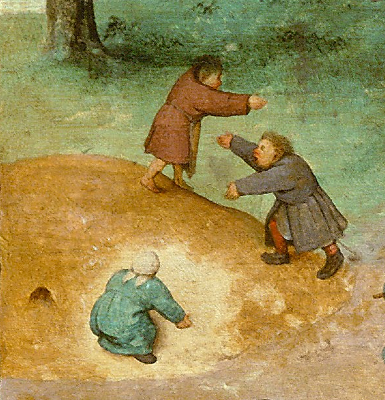
A 'castle hill' might also have got its name simple because it roughly looks like a castle motte or because generations of children (and in days before mass entertainment many adults) have played 'king of the castle' at the site (The principle of this simple game is ancient but the 'king of the castle' name seem to date back at least as far as the 17th century.).
Some grand houses of the The Gothic Revival had 'castle' names but are generally clearly seen as post-medieval although sometimes fanciful histories for these houses were made and can lead to confusion. However, some Gothic Revival houses are built on the site of, or even incorporate, medieval castles and buildings. (i.e. Alton Castle, Staffordshire). Even excluding Gothic Revival buildings some relatively modest houses, even at fairly early dates, may have been given the title of castle by grandiose owners. They certainly were at later dates, sometimes confusing things even more with fictional 'histories' of earlier origins intended to increase the kudos of the owner. At another extreme some small, mean shepherd's huts in mountain areas and other such tiny dwellings may have 'castles' names because of ironic humour.
The revival of interest in the medieval period during the 18th and 19th centuries lead to a fashion for building ruins of 'castles' in elite garden landscapes. These follies were often cheaply built and many have been lost leaving no remains. Some Castle Hill and other castle place-names refer to such post-medieval garden or parkland features.
Some rocky crags or hills can look particularly impressive and, despite being entirely natural, get castle names to reflect this. This may be particularly true of crags close to moorland drovers route-ways or some coastal cliffs, where features needed to be named and remembered by drovers or sailors for navigation purposes.
A final reason for a place getting a castle place name is that the area,
although not altered and remaining natural, is used as a place of retreat.
There are some isolated valleys deep in the welsh mountains with castell or similar place names which seem highly unlikely as the sites of lordship castles but are
exactly the sort of place where people would 'retreat to the hills' in times
of trouble. Here, it may be that oral history has preserved as a place name
a semi-secret location. There is also at least one lazencastle which
was possibly an unofficial, unsupported leper colony.
This page last updated 24 April 2015